The Kangaroo Industries Association of Australia (KIAA) has been receiving enquiries about the status of kangaroo harvesting during this unprecedented bushfire season. Many of us are based in regional and rural Australia and have witnessed the devastating effects of drought and bushfires on our communities, natural environment and wildlife.
We would like to assure Australians and the world that the protection of kangaroo and wallaby populations is of the utmost importance to us now and always. We are working closely with state and federal governments to monitor bushfires as well kangaroo populations of the four harvested species in different regions of Australia to determine the impact and react accordingly.
To date, the bushfires have not put harvesting operations at risk nor have kangaroo populations been impacted in a way that calls for planned harvesting to be put on hold nationwide. However, it is important to consider that:
- Kangaroos are mobile animals that are generally able to move away from areas where they sense danger. While this does not prevent all kangaroo casualties, it does avoid large-scale losses as seen with animals such as koalas.
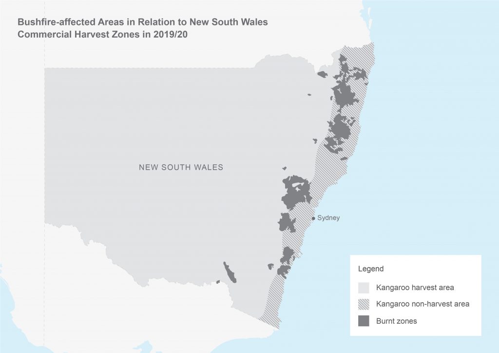
- The catastrophic bushfires have mostly occurred in national parks, particularly those on the east coast of NSW where kangaroos are not harvested (see maps below). While there is some overlap, the majority of harvest areas has not been impacted by the fires.
- Australia is a vast country and harvesting operations can be adapted to focus on areas away from bushfires for the wellbeing of harvesters, landowners and animals.
- Victoria has temporarily put its Kangaroo Harvesting Program on hold in parts of the State and issued new cull quotas for 2020.
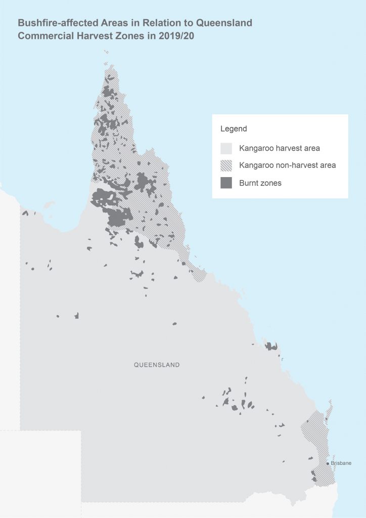
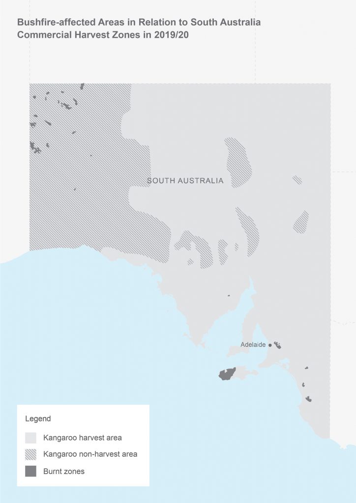
Bushfire and harvest maps
The maps below show the commercial kangaroo harvest areas in NSW, Qld and SA as well as the areas burnt by the bushfires in the 2019/20 bushfire season as of 16 January 2020.
Please note:
- The data is based on information supplied by the state governments and rural fire services.
- This map should not be used as an indication of where fires are currently burning or danger levels in specific areas. Please refer to the state and territory rural fire services for up-to-date reports of where bushfires are burning and advice on how to respond.